Liveable cities
In mid-March, the country was put into an Enhanced Community quarantine (ECQ). Over time, different parts of the country were declared under Modified Community Quarantine (MECQ) or General Community Quarantine (GCQ). By June 1st, most of the country shifted to GCQ. The shift to GCQ, however, doesn’t mean that the danger of infection has passed. We still need to remain vigilant.
In light of community quarantine still, in place where people are still required to stay at home, technology and data can play a big role in combating this pandemic. Technology makes it possible to track the spread of COVID-19 across the country, down to Cities and Municipalities. Such data will help national and local decision-makers make the right public policy decisions to help manage this pandemic.
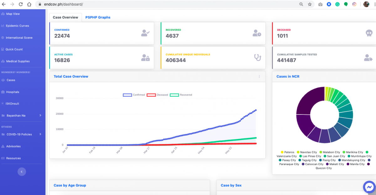
The University of the Philippines Resilience Institute (UPRI), in collaboration with the UP Nationwide Operational Assessment of Hazards (NOAH), has developed a dashboard that tracks the spread of COVID-19 in the Philippines called ENDCOV PH (http://endcov.ph/). The website aims to provide people with information for tracking the number of confirmed COVID-19 cases, recovered patients, deaths, patients under investigation (PUI, now called Suspects) and persons under monitoring (PUM, now referred to as Probables).
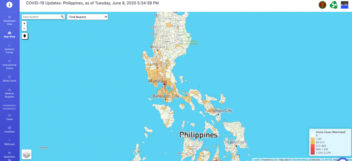
Endcov.ph features an easy-to-use map and uses a color-coded “heat map” which shows localized areas that have the most (darker areas) and the least (brighter areas) number of confirmed COVID-19 cases.
In order to ramp up data gathering, endcov.ph encourages submissions from Local Government Units. The endcov.ph dashboard also contains information such as a directory of hospitals all over the country, announcements and advisories from the Department of Health and World Health Organization, links for donations, and other resources on health, education, economic support, and mobility policies.
The website can be accessed using this link: http://www.endcov.ph

